
Search by Postcode
Map of the best Hotels near the DE7 5FR Postcode in Third Avenue, Ilkeston
We have searched high and low to find the best hotels near the DE7 5FR postcode in the historic county of Derbyshire.
The DE7 5FR postcode is situated in Ilkeston. We have found hotels nearby.
Use our easy to use hotel map or comprehensive accommodation listings to find the right DE7 5FR hotel for you.
| Zoom Level | Latitude | Longitude |
| 6 | 53.521968 | -2.164306 |
Hotel Deals for DE7 5FR Postcode in Third Avenue, Ilkeston
The Nearest Hospitals to DE7 5FR Postcode in Third Avenue, Ilkeston
| Hospital Name | Operator | Distance Km | Distance Mi. |
|---|---|---|---|
| Ilkeston Community Hospital | Heanor Road, , DE7 8LN | 2.59 | 1.61 |
| Highbury Hospital | Highbury Road, Nottingham, Nottinghamshire, NG6 9DR | 8.26 | 5.13 |
| Nottingham University Hospitals NHS Trust - Queen's Medical Centre Campus | Derby Road, Nottingham, Nottinghamshire, NG7 2UH | 8.55 | 5.31 |
| CircleNottingham NHS Treatment Centre | Nottingham NHS Treatment Centre, Lister Road, Nottingham, NG7 2FT | 8.86 | 5.51 |
Cheap Hotels near the DE7 5FR Postcode in Ilkeston
The 10 nearest Budget hotels to the DE7 5FR Postcode offering economy accommodation
| Budget Hotel Name | Distance |
|---|---|
| 1:
Travelodge Nottingham Trowell M1 | 4.43 km (2.75 Miles) |
| 2:
Travelodge Nottingham Wollaton Park | 10.65 km (6.62 Miles) |
| 3:
Premier Inn Nottingham West | 11.31 km (7.03 Miles) |
| 4:
Premier Inn Ripley | 14.17 km (8.80 Miles) |
| 5:
Premier Inn Nottingham North West Hucknall | 14.40 km (8.95 Miles) |
The Nearest Airports to DE7 5FR Postcode in Third Avenue, Ilkeston
| Airport Name | Distance Km | Distance Mi. |
|---|---|---|
| East Midlands Airport | 15.54 | 9.66 |
| Robin Hood Doncaster Sheffield Airport | 60.50 | 37.59 |
| Birmingham International Airport | 63.73 | 39.60 |
The Nearest Stations to DE7 5FR Postcode in Third Avenue, Ilkeston
| Station Name | Operator | Distance Km | Distance Mi. |
|---|---|---|---|
| Langley Mill | East Midlands Trains | 5.98 | 3.72 |
| Bulwell | East Midlands Trains | 8.35 | 5.19 |
| Beeston | East Midlands Trains | 8.39 | 5.21 |
Places to Stay near the DE7 5FR Postcode
Durham Ox Ilkeston
| Durham Ox Ilkeston |
| Distance in Km 1.11 |
 |
| View entry for Durham Ox Ilkeston on Bed Map |
Anson House
| Anson House |
| Distance in Km 2.15 |
 |
| View entry for Anson House on Bed Map |
Chatterley House
| Chatterley House |
| Distance in Km 2.79 |
 |
| View entry for Chatterley House on Bed Map |
Lavender Cottage
| Lavender Cottage |
| Distance in Km 3.29 |
 |
| View entry for Lavender Cottage on Bed Map |
Travelodge Nottingham Trowell M1
| Travelodge Nottingham Trowell M1 |
| Distance in Km 4.43 |
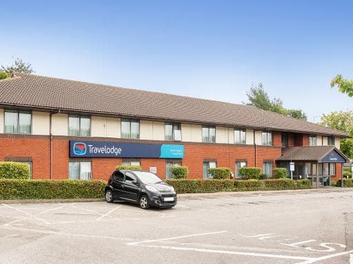 |
| View entry for Travelodge Nottingham Trowell M1 on Bed Map |
Hogs Head Hotel
| Hogs Head Hotel |
| Distance in Km 5.00 |
 |
| View entry for Hogs Head Hotel on Bed Map |
Springfield Mill - Industrial Style Serviced Apartments
| Springfield Mill - Industrial Style Serviced Apartments |
| Distance in Km 5.19 |
 |
| View entry for Springfield Mill - Industrial Style Serviced Apartments on Bed Map |
Holiday Inn Derby/Nottingham
| Holiday Inn Derby/Nottingham |
| Distance in Km 5.28 |
 |
| View entry for Holiday Inn Derby/Nottingham on Bed Map |
Whiteley Mill
| Whiteley Mill |
| Distance in Km 5.61 |
 |
| View entry for Whiteley Mill on Bed Map |
The Horse and Jockey
| The Horse and Jockey |
| Distance in Km 5.61 |
 |
| View entry for The Horse and Jockey on Bed Map |
Risley Hall Hotel
| Risley Hall Hotel |
| Distance in Km 5.70 |
 |
| View entry for Risley Hall Hotel on Bed Map |
Sun Inn
| Sun Inn |
| Distance in Km 5.79 |
 |
| View entry for Sun Inn on Bed Map |
Novotel Nottingham Derby
| Novotel Nottingham Derby |
| Distance in Km 6.25 |
 |
| View entry for Novotel Nottingham Derby on Bed Map |
Best Western Nottingham Derby
| Best Western Nottingham Derby |
| Distance in Km 6.36 |
 |
| View entry for Best Western Nottingham Derby on Bed Map |
Eastwood Hall
| Eastwood Hall |
| Distance in Km 6.53 |
 |
| View entry for Eastwood Hall on Bed Map |
Park Hall Glamping Pods
| Park Hall Glamping Pods |
| Distance in Km 6.63 |
 |
| View entry for Park Hall Glamping Pods on Bed Map |
Best rates for essential workers and contractors Parking wifi
| Best rates for essential workers and contractors Parking wifi |
| Distance in Km 7.53 |
 |
| View entry for Best rates for essential workers and contractors Parking wifi on Bed Map |
Nottingham Serviced Accommodations
| Nottingham Serviced Accommodations |
| Distance in Km 7.55 |
 |
| View entry for Nottingham Serviced Accommodations on Bed Map |
Is a Hotel Missing?
Let us know the Name, Address and Postcode and we’ll add it to our listings.
Contact Us